Boston’s Planning & Development Agency has been busy. Courtesy of the aforementioned, you can download CAD files in a variety of formats of the entire city and see visualizations of city-wide data like flooding and energy usage.
For the longest time, the city of Boston’s Planning & Development Agency officials would consult a detailed wooden model of the city when considering new builds. Imagining a proposed building surrounded by its would-be neighbors gave the agency context to better judge the merits and drawbacks.
But, stuffed away on the ninth floor of City Hall, the model was hardly up to scratch in light of the BPDA’s aim to be more transparent with its denizens.
Since it’s 2018, and computers and the internet and other stuff like that exist, the agency has created a sophisticated digital recreation of the entire city, covering some 129,000 buildings across the entire city’s breadth.
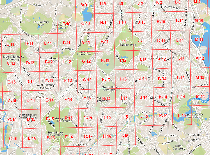
Accessible online in a variety of CAD formats, the city is split up into 1km blocks. Perhaps the most interesting thing for us is that the city can be downloaded as files for SketchUp — meaning the possibility to export as STLs and (we imagine after extensive repairing), maybe even 3D print. Sadly, this requires a paid up version of SketchUp Pro (we couldn’t find a way to import the models into the free browser-based SketchUp).

Boston From Above
More than your typical Google Maps rendering, the BPDA has gone all out on their new model. Planners can view the sections of the city under certain lighting conditions, and features in development will go as far as to show the vantage points of the city within view of certain landmarks.
Additionally, as a coastal city under threat from rising sea levels, the model is unique in making projections and known flood risks dynamically available for the public to see. That, plus a simulation of the city’s energy usage. Even half the world away with no real knowledge of Boston, it makes for some pretty compelling procrastinating.
Speaking of the model’s development, Brian Golden, Director of the BPDA explains: “By providing a sophisticated planning tool like our 3D smart model to the public free of charge, we are creating a new resource to improve the efficiency and quality of our work“. Such data sharing is always a good thing, and something we hope to see emulated elsewhere. Golden continues that the work is “empowering residents with a real-world visualization tool to imagine the future of our neighborhoods, and leveling the playing field for all who are invested in planning Boston’s urban context“.
The agency claims the model contains only the currently existing buildings, leaving out the proposed structures the BPDA is considering. Rather than downloading segments, a browser-based version contains the entire city to pan, zoom and layer information over at your pleasure.
Source: Boston Globe
License: The text of "Download Your Very Own Digital Copy of Boston" by All3DP is licensed under a Creative Commons Attribution 4.0 International License.